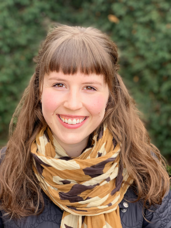
Morgan A. Crowley
|
PhD Candidate (Department of Natural Resource Sciences)
Research Interests: fire mapping, disturbance detection, Remote sensing, multi-source data synthesis, Landsat, Sentinel-2, MODIS, Google Earth Engine, Bayesian Updating of Land Cover algorithm Extreme fire seasons are becoming increasingly common across Canada, and annual burned area is predicted to escalate. Widespread and large fires impact ecosystem services such as timber supply, wildlife habitat, and carbon storage, and diminished air quality has a detrimental effect on human health and well-being. Accurate maps of active fire progression can help stakeholders fight fires, better understand how they burn, and model future landscape disturbance and subsequent impacts on ecosystem services. The primary objective of my thesis is to develop data fusion methods to produce and analyse decades of fire progressions at the provincial level. By using novel classification and data-fusion methods to refine burned-area mapping, this dataset and subsequent analyses hope to offer insights to the fields of fire ecology and disturbance monitoring. ResearchGate |
Eliza Sarah Deutsch
|
Postdoctoral Research Fellow
Research Interests: Aquatic ecosystem ecology, global change, aquatic monitoring in data-poor regions, statistical modeling, remote sensing, GIS. Eliza is working on a Canada-wide multi-university and multi-agency project assessing the health of lakes across the country. Her work involves developing empirical remote sensing algorithms for predicting water clarity, modeling the relationship between lake biochemistry, lake optical properties and watershed characteristics to develop an index of health, and then interpolating the assessment of health to all lakes in Canada. ResearchGate |
Elijah Perez
|
MSc of Natural Resource Sciences
Research Interests: Fire mapping, remote sensing, Landsat, Sentinel-2, BULC (Bayesian Updating of Land-Cover), GIS Eli completed his undergraduate degree at McGill University in Environmental Biology specializing in Wildlife Biology and is now a first year masters student in NRS. His remote sensing work, under the supervision of professor Jeff Cardille, allows him to blend his scientific and professional interests at the intersection of remote sensing, cloud computing, and the natural world. He hopes to improve the detection of forest disturbances in British Columbia with potential application Canada wide, helping to improve forest management. Google Scholar ResearchGate |
Talia Koll-Egyed
|
MSc of Natural Resource Sciences
Research Interests: Lakes, Coloured dissolved organic matter, Secchi disk depth, Remote sensing, Landsat- 8, Sentinel-2, Google Earth Engine Canada is rich in freshwater resources, boasting approximately 20% of the global supply. These resources are under increasing human pressure, with climate change already impacting both the availability and quality of freshwater. Despite their importance in Canada, a national-scale accounting of lake water parameters has, until very recently, been impossible. With the large field effort of the NSERC Lake Pulse Strategic Network, hundreds of lakes have been sampled as the basis for a nationwide lake assessment. Yet with hundreds of thousands of never-sampled lakes to consider, satellite data provides the only viable means for extensive monitoring of these bodies of water. The primary objective of my thesis is to develop algorithms to predict the concentration of coloured dissolved organic matter and Secchi disk depth. This research will expand our knowledge of lake water quality parameters at a country-wide scale and provide a baseline estimate for carbon content in the lakes of Canada. |
Eleanor Stern
|
M.Sc. Student of Natural Resource Science (specializing in Wildlife Biology) Research Interests: Wildlife science, wildlife epidemiology/disease, local and expert wildlife knowledge, conservation biology. As a masters student at McGill, I'm a full time student and nature enthusiast. I've wanted to be a wildlife scientist for as long as I can remember, and I'm thrilled to be working on my current moose project. In the past, I've done research projects on geophysics with Dr. Jeff Gu, forest fragmentation with Dr. Scott Nielsen, and wildlife disease with Dr. Eveyln Merrill. I'd like to continue down the wildlife conservation path at the PhD level, whether that be focused on disease, habitat use, behaviour, or ecology. I'm most interested in applied, tangible projects and research with real-world impacts, and research with a strong quantitative or modeling component. My interests outside of research include horse riding, knitting, and backpacking (which I'm good at), piano (which I'm mediocre at), and archery (which I'm just learning). I believe the best scientists are well rounded people with varied interests and hobbies, and I strive to continue learning new things and expanding my horizons while I continue my masters degree. Google Scholar Research Gate |
Eidan Willis
|
Technician (B.Sc Environment Water Environments & Ecosystems, minor in Japanese)
Research Interests: remote sensing, aquatic ecology, coastal ecology, GIS, google earth engine, BULC-D (bayesian updating of land cover – version D), linear and harmonic modeling, time series analysis, Z-scores, forest monitoring, fire mapping I'm an undergraduate student currently working towards a B.Sc in Environment (Hons.), specializing in Water Environments & Ecosystems – as well as a supplementary minor concentration in East Asian Language (Japanese) – in McGill's Bieler School of Environment. During a gap year between high school and university, I spent a few months in the Bahamas assisting researchers with their work and, in the process, developed a passion for marine ecology, tropical ecology, scuba diving, and ocean exploration. Following the completion of my degree, I hope to find a way to bridge my interest in GIS and remote sensing with my passion for the ocean and tropical environments. In Summer 2021, I assisted Dr. Cardille in improving the BULC algorithm to utilize harmonics to model the natural seasonality of vegetation on a per-pixel basis over varying temporal and spatial scales. I've continued this work in the form of an Honours Project aimed at improving the algorithm’s ability to accurately interpret, classify, and differentiate wildfire burn-scars, deforestation events, vegetation regrowth, and other instances of vegetation change over time. |
Katerine Grandmont
|
Étudiante à la maîtrise (2010-2013)
Directeur: Daniel Fortier, Laboratoire de géomorphologie et géotechnique des régions froides Co-Directeur: Jeffrey Cardille, Laboratoire d'écologie du paysage Département de Géographie de l'Université de Montréal |
Cartographie évolutive des risques liés à la dégradation du pergélisol afin de guider le développement de l'environnement bâti pour quatre communautés du Nunavik
Dans le cadre de mon projet, j'étudie les villages de Puvirnituq et Akulivik, situés sur la côte est de la Baie d'Hudson, et les villages de Kangirsuk et Tasiujaq, situés sur la côte ouest de la Baie d'Ungava. Ces quatre communautés sont situées dans le nord du Québec et sont particulièrement touchées par le réchauffement des températures, qui a un impact important sur la dégradation du pergélisol.
Mon travail consiste à développer une méthodologie permettant de produire des cartes d'évaluation des risques en lien avec la fonte du pergélisol. Ces cartes seront ensuite utilisées par les communautés concernées afin de les guider dans la relocalisation de certains bâtiments présentement situés dans des zones à risques et de les aider à planifier l'emplacement de nouvelles infrastructures.
Affiliations
Centre d'études nordiques (CEN)
Permafrost Young Researchers Network (PYRN)
Association of Polar Early Career Scientists (APECS)
Jean-Baptiste Lequet
|
Étudiant à la maîtrise (2010-2012)
Codirecteur: Paul Del Giorgio, département de Biologie de l'UQAM. Télédétection du carbone organique dans les lacs boréaux. Je m'intéresse aux possibilités d'estimation de la teneur en carbone des lacs boréaux du Québec à l'aide d'images satellites prises par le capteur Advanced Land Imager (ALI), qui est un prototype de la nouvelle génération de capteur terrestres de la NASA. J'applique une méthodologie développée à l'université d’Uppsala en Suède qui repose sur l’utilisation de plusieurs bandes spectrales. Cette recherche repose sur un travail de terrain mené par les membres de la chaire de recherche BiCÉAB. |
Kevin Partington
Étudiant à la Maîtrise (2009-2012)
Titre actuel du projet de recherche :
Délimitation géographique des patrons de la végétation & Identification des paysages représentatifs :
Utilisation des indices de patrons de paysage à l'échele du Québec?
Je m'intéresse à l'étude des patrons des paysages, plus particulièrement, de la forêt québécoise et canadienne. Je suis captivé par le développement d'outils d'aide à la surveillance de la forêt à l'échelle nationale et continentale, notamment par les systèmes d'information géographique, la télédétection et l'écologie numérique.
Mon projet actuel de recherche consiste à découper la Belle Province en région en fonction des patrons représentatifs de la végétation, d'évaluer spatialement la représentativité d'un tel découpage de par la similitude des patrons, et via l'identification des paysages représentatifs du Québec. Pour ce, j'utilise des données matricielles sur couverture végétale, des indices de patrons (landscape metrics), et un algorithme de propagation d'affinité.
Cliquez ICI pour consulter une récente présentation sur les derniers développements de ma recherche.
Cliquez ICI pour consulter le site internet de mon projet.
Rodolphe Gonzales
Étudiant à la maîtrise (2007-2009)
Je travaille sur l'utilisation de nouvelles méthodes de visualisations cartographiques comme support au partage de données scientifiques. Plus particulièrement, mon projet consiste à la création, autour d'un globe virtuel, d'un outil de partage et de visualisation spatiotemporelle de données liées à la foresterie.
D'une manière générale, je m'intéresse à la création musicale et cinématographique, ainsi qu'aux questions politiques et environnementales.
Alexis Dorais
Étudiant à la maîtrise (2008-2010)
Co-directeur Rodolphe de Koninck, Département de Géographie.
Mon projet consiste à cartographier l’expansion de la palme à huile à Bornéo. Cette cartographie se fait principalement à l’aide d’images satellites de MODIS. En outre, je tire profit de la vaste archive d’images Landsat qui, depuis peu, est accessible gratuitement dans son intégralité.
Mathieu Ouellette
|
Chercheur pendant le baccalaureat, 2009-2010
Je possède un B.Sc. en géographie environnementale de l'Université de Montréal. Je me suis joint au laboratoire de Jeffrey Cardille à l'hiver 2009 en tant qu'étudiant au premier cycle. J'ai alors travaillé sur un projet d'analyse des domaines vitaux et de l'utilisation de l'habitat par les tortues dans la rivière des Mille-Îles (Québec). Dans le cadre de ma maîtrise, je poursuis dans cette voie. Mon projet consiste à développer des scripts Python et un plugin pour un SIG (système d'information géographique) dans le but de faciliter l'analyse des domaines vitaux. Mes intérêts sont vastes mais dans le domaine de la géographie je m'intéresse particulièrement à la géomatique et à l'écologie du paysage. |
Noé Pflieger
Etudiant en maîtrise d'intelligence territoriale et en aménagement en géographie à Besançon (France), je suis mes cours à l'Université de Montréal en 2008/2009. Je possède une licence (bacc.) de géographie et aménagement. Je travaille sur les conséquences environnementales et sociales des changements de l'occupation du sol dans la région du Kinabatangan, au Nord-Est de l'île de Bornéo. Le palmier à huile prend peu à peu la place des forêts vierges, et je tente de mesurer et de cartographier ce phénommène encore méconnu à telle échelle locale grâce à la télédétection et aux SIG.
Julie Fortin
Final year undergraduate (B.Sc. Honours Earth System Science)
Bayesian Updating of Land Cover Classifications
My project involves assessing landscape change including deforestation in Brazil, forest fires in northern Quebec and urban expansion in Las Vegas. To accomplish this, I take loads of land cover data from a wide variety of sources, do regression tree classifications on them using Google Earth Engine, and run them through an algorithm we created in R which applies bayesian statistics to update those classifications.
Fun fact: I was the captain of the McGill Figure Skating team!
David Pelletier
|
MSc Candidate (Department of Natural Resource Sciences)
My research interests are in landscape connectivity and forest fragmentation. I used to be a system administrator and web developer before doing the jump into physical geography and landscape ecology. As such, my research centers on computer modelling and automating tasks to process large quantities of spatial data. My main project involves using the Circuitscape software to model omnidirectional connectivity at high resolution over very large areas, such as administrative regions and even the whole extent forested areas in Canada. The resulting connectivity maps can be used to prioritize areas for conservation and preservation as well as guide commercial activities such as logging. David Pelletier est étudiant à la maîtrise au campus Macdonald de l'université McGill en écologie du paysage. Il a travaillé près de 10 ans en informatique en tant qu’administrateur réseau, designer et programmeur web et expert en accessibilité du web pour les personnes aveugles et handicappées avant d’effectuer un retour aux études en géographie physique. Il s’intéresse principalement à la connectivité du paysage à petites et à grandes échelles ainsi qu’aux défis que représente la fragmentation des forêts. Il utilise les systèmes d’information géographique, des modèles et programme des outils pour automatiser le traitement de grandes quantités de données géographiques. |
Valerie Hayot-Sasson
|
Final year BCompSci; BSc. Environmental Biology
Project Title: Landscape connectivity using Circuitscape. The project I am working on involves creating skeletons based on Circuitscape's landscape connectivity results. This is accomplished by inputting a raster with resistance values into Circuitscape and applying image processing techniques to create the skeleton. |
Max Zworth
|
Second Year Undergraduate (B.A.Sc. Interfaculty Environment)
I serve as general support for a number of projects underway in the lab. I am assisting with the editing process of the newest publication of the textbook Learning Landscape Ecology, by test-running exercises, programs and projects designed by Professor Cardille to assist graduate and undergraduate students with the study of computational landscape ecology. I also helped build this website. |
Jacky Lee
|
MSc Candidate (Department of Natural Resource Sciences)
Research Interests: Landscape ecology, Remote sensing, spatial ecology, community ecology, invasion ecology. Humans are causing extraordinary changes in our environment from changes in land use to introduction of invasive species. It is important then to track these changes and identify areas where we are able to target conservation efforts to conserve biodiversity. As technology has improved to the point where it is now possible to see time lapse changes in landscape using remote sensing techniques in real time. In my project. I have developed the tools needed in Google Earth Engine platform to quickly update classifications. I use Bayesian statistics, machine learning, fine scale satellite images, and global level land cover classifications to create time series of land cover classifications which are downscaled and accurate. The algorithm called Bayesian updating of land cover classifications: Unsupervised (BULC - U) allows the creation of land cover classification in minutes using fine scale satellite images. My MSc thesis focused on creating and using BULC-U to track changes in the Brazilian Land cover over 14 years. |
Eric Davies
Bachelors of Computer Science Student (2015-2018)
Focus on: Project support, development, and maintenance along with documentation and support of past projects.
Computer Science is a field to itself, complex to its own right. Expecting researchers to understand how to take advantage of computers while being knowledgable of their own field is asking them lose time in their field of choice to learn about computers. As a programmer, my task is to bridge this gap by making advantageous computer technologies available to our team. This has led to support of the BULC algorithm for the Google Earth Engine, support and development of the student learning tool Metaland and it's child Metrics Finder, and general project support for a multitude of different projects being developed in this lab. My focuses are on code optimization and knowledge accessibility, two aspects that are key in bringing programming to a general audience.
Xavier Giroux-Bougard
|
PhD Candidate (Department of Natural Resource Sciences)
Research Interests: Landscape genetics, landscape ecology, functional connectivity, spatial ecology As the configuration and spatial structure of landscapes change, conservation biology and wildlife management are ever more concerned with the degree of flow and movement of individuals within and between wildlife populations, defined as functional connectivity. Understanding how species use habitat to disperse and migrate is critical in assessing the long-term viability of their populations as well as developing improved tools to identify areas which significantly contribute to the connectivity of the landscape. My research focuses on optimizing models of landscape connectivity using population genetic data as a proxy for long term wildlife movements at large scales. Specifically, I am interested in: (1) understanding how individual species respond to large disturbances in a landscape (forestry, forest fires, etc...), (2) understanding how much time it takes to restore the functional connectivity of a disturbed landscape, and (3) developing new tools to build landscape connectivity models which optimize the functional connectivity of multiple species. |
