|
|
My research focuses on understanding environmental change by studying the causes and consequences of spatial variation in ecological processes.
Here are some of my major research projects you might like to know more about: |
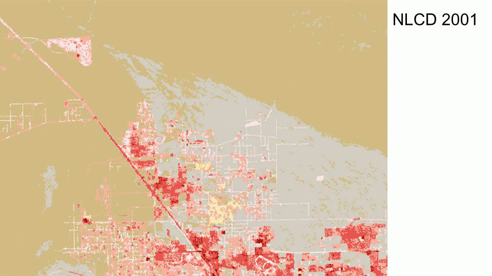
Bayesian Updating of Land Cover (BULC)
|
BULC (Bayesian Updating of Land Cover Classifications) is an algorithm developed in my lab to provide users with time series of land cover classifications. The algorithm ingests images that have been classified through time, without the need for each land classification to be near-perfect. BULC assesses the agreement between classifications, and uses Bayesian statistics at each time step to update its estimate of land cover, producing a "posterior" classified map. This posterior map is the algorithm's best estimate of land cover at the time of the last input image.
|
Representative Landscapes
|
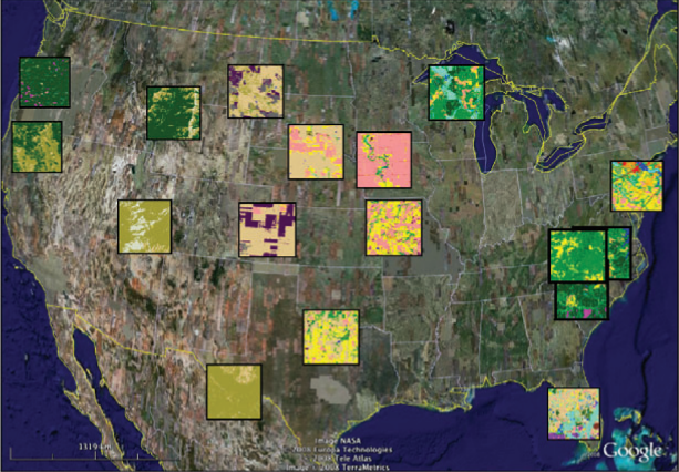
Click here for a pdf copy of “From The Redwood Forest To The Gulf Stream Waters: Human Signature Nearly Ubiquitous In Representative U.S. Landscapes”. (link to be updated)
In the April 2010 issue of Frontiers in Ecology and the Environment, we identified exemplar landscapes of the continental United States. These landscapes were selected using the 1992 Metaland database by the affinity propagation algorithm, which quickly and objectively chooses representative items from large sets. (link to be updated) Click to learn more about this project and see these landscapes embedded in a web page (which does not require a copy of Google Earth) (link to be updated). Or, you can get the full tour by downloading the kmz file for viewing in your own copy of Google Earth. |
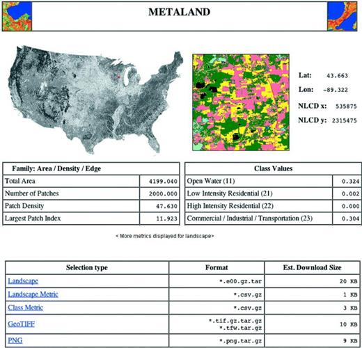
Metaland
|
This tool allows researchers and policy makers to understand the distribution of landscape metric values across large areas, and to identify the locations of and select landscapes according to any number of pattern-oriented criteria. Click here to access Metaland.
See the publication here. A free PDF copy of the Bioscience article, "Metaland: a publicly available tool for characterizing spatial patterns and statistical context of landscape metrics across large areas" should be visible on that page. |
Learning Landscape Ecology (Second Edition)
|
In the second edition of Learning Landscape Ecology, I am co-author of three book chapters. Each chapter has a computer component, and we have produced student guides that you can consult when doing the lab work. See below for the links:
|
