During my years at the Université de Montréal, I was committed to enlarging the French-speaking community's access to the rapidly evolving world of GIS and spatial analysis. By guiding student participation in a sustained effort spanning multiple years and all four of my courses, I developed a very wide range of online educational materials for use by everyone. In each course, I devised strategies for the students to both learn from and contribute to the world outside the university's walls. Here are some links to the various projects of the students of those courses.
Wikipedia
Applications de SIG
Students developed an entirely new French Wikipedia page highlighting more than 50 highly varied applications of GIS. These included applications of GIS in natural resource management, human health, among many others. Since its creation, this page has been modified and improved considerably by the wikipedia community, and was viewed more than 15,000 times in its first 3 years.
(En français, en-ligne). (Cours Géo 2512, Automne 2008)
Annotated Books
|
Annotated Summary of Heywood, Intro to GIS, 3e edition
Students annotated an English-language GIS course book in French, for their own use and for the use of others. The book is Introduction to Geographical Information Systems, third edition, by Heywood et al. (links to be updated) (En français, en-ligne). (Cours Géo 2512, Automne 2009) |
Annotated Summary of Gorr-Kurland, Livre des TPs, 3e édition
Students annotated an English-language GIS Laboratory Exercise Manual in French, for their own use and for the use of others. The book is GIS Tutorial: Workbook for ArcView 9, by Wilpen L Gorr, Kristen S Kurland, third edition. (En français, en-ligne). (Cours Géo 2512, Automne 2009) |
Laboratory Exercises Written by Students
Students have written GIS-oriented lab exercises designed to introduce others to a set of concepts and/or skills in GIS. Each laboratory exercise is tested and improved by other students, annotated by the author and by other students, and uses publicly stored and available data so that others can do the exercises as written.
(En français, en-ligne). (Cours Géo 6342, All Semesters)
(En français, en-ligne). (Cours Géo 6342, All Semesters)
Where and how is GIS used?
Students have developed short presentations highlighting applications of GIS in a multitude of settings. These pages describe those presentations, present links to sources of information and data, and give a question and answer that encapsulates the presentation.
Pages in 2010 and beyond include links to the presentations themselves, stored permanently as Google Presentations.
(En français, en-ligne). (Cours Géo 2512, Automne 2010, Automne 2009, Automne 2008, Hiver 2008)
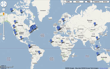
See a Google Map of locations of some of the presentations
By Year: 60 Short Presentations About GIS
150 Older Summaries of Presentations About GIS
Pages in 2010 and beyond include links to the presentations themselves, stored permanently as Google Presentations.
(En français, en-ligne). (Cours Géo 2512, Automne 2010, Automne 2009, Automne 2008, Hiver 2008)
See a Google Map of locations of some of the presentations
By Year: 60 Short Presentations About GIS
150 Older Summaries of Presentations About GIS
Annotated links to Other GIS resources
Links to GIS resources
Students create and maintain a list of links to information about GIS outside our courses. Sections include Portals and Forums, Glossaries and Dictionaries, GIS Terminology, On-line tools, Open-source GIS, Data Sources, and others.
(En français, en-ligne). (Cours Géo 2512, All Semesters)
Students create and maintain a list of links to information about GIS outside our courses. Sections include Portals and Forums, Glossaries and Dictionaries, GIS Terminology, On-line tools, Open-source GIS, Data Sources, and others.
(En français, en-ligne). (Cours Géo 2512, All Semesters)
Annotated Links to Online Laboratory Exercises in GIS
Annotated Links to Other On-line GIS Lab Exercises
Students located and annotated in detail more than 100 laboratory exercises from the world of GIS. Often developed at other universities or organizations, these exercises are often useful to provide practical experience in a GIS or spatial analysis skill. Students annotated each exercise to identify the stated goal, the programs used, the availability of the data, and the provenance of the lab exercise itself. Because many of the lab exercises available on the internet are written in English, this annotation can save hours of effort and searching.
(En français, en-ligne). (Cours Géo 6342, All Semesters)
Exploring the World of Google Maps
|
Students located and annotated in detail hundreds of web sites, blog postings, and applications of the latest developments of Google Earth and NASA WorldWind. These "virtual globes" have become a standard way of viewing the earth for millions of lay people and scientists alike. Students searcheded for, annotate, and presented these links to keep pace with this rapidly changing field.
(En français, en-ligne). (Cours Géo 6352, All Semesters) (Links to be updated) |
Online Coursework and Course Plans
|
Geo 2512: Introduction to GIS
|
